


 to add an item to your Itinerary basket.
.png)

You are here > Home > Inspire Me > Discover Durham's Great Outdoors > Walking > Wolsingham Family Walk
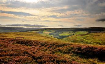
Wolsingham Family Walk
Wolsingham
Bishop Auckland
Co Durham
DL13 3AP


About
Distance: 1..5 Miles
Grade of walk: Moderate
From the car park cross the recreation ground to the River Wear. Turn left along the banks of the river and under the iron Bridge built in 1894. The river has moved in recent years and now flows nearer the south bank, exposing wooden supports of an older bridge. This is the lowest point of the walk and can be flooded after heavy rain. Please take care.
Turn left immediately up the side of the bridge taking care as the path is steep. Follow the road ahead towards the High Street. Continue along the river bank which, in summer is a popular bathing area.
In the early 19thC the banks on both sides of the bridge were a hive of industrial activity. A mill race powered numerous small factories and ran through what is now the recreation area to a mill pond on the site of the caravan park. Pass through the caravan park and on to the south-east corner of the Market Place. There are many dropped kerbs to assist in crossing the roads. (Alternative Route. To return to the Recreation Ground turn left in the Market Place and return along the main street passing the bank and a variety of shops). To follow on the main route, go north along the pavement up the east side of the Market Place to the junction of Angate and Meadhope streets. There are public toilets on the left hand side of the road. Continue along Angate Street where you will pass, on the right, an 18thC three-storey house known as 'Rivendeu: which was once a brewery. The former St Anne's convent on the left has been attractively converted into apartments. Next door is St Thomas' Church, the only Catholic Church in Weardale amongst the many Wesleyan Chapels. A scenic 'alternative route' along Meadhope Street is a delight to visit but it has steep, narrow sections on the footpath which may be difficult to negotiate for those using a manual wheelchair.
Take the footpath on the left side of the street as the other has narrow points which can be difficult to negotiate. At the end of Meadhope Street, note the unusual outside staircase to the end house.Take care as the path is steep and narrow. Turn left into Silver Street and Angate Square, a small green surrounded by six Lime trees. Then up a sharp incline to rejoin Angate Street at the former convent. Both Routes Enter Demesne Mill picnic site. The name originates from the cornmill, probably established in Norman times. The mill was powered by the Waskerley Beck which runs on the right of the footpath and was demolished in 1951. A short diversion to the right along the side of the river brings you to a series of waterfalls and pools known as the 'Sills; a great attraction to children and, when it is quiet to Herons and Dippers.
Return to rejoin the main route up a short steep slope to the right between fields. There is a fine view of the Parish Church of St Mary and St Stephen on the left. Ahead is Wolsingham School and Community College, established in 1958, with its extensive playing fields. Turn left at the end of this lane towards the churchyard.
'Short Cut’ Go through the churchyard, passing the church on your left and into Church Lane. To the right is the 18th century building which housed the Grammar School (founded 1614) until 1911. It is now used as the Church Hall. Continue straight down Church Lane to the main street, turn right and return to the Recreation Ground. To continue on the main footpaths, turn right at the churchyard corner and walk along what is locally known as 'Lovers Lane'. At the entrance to the College, turn left into Tunstall Lane and proceed to the junction with the main road. Here, on the right, are the buildings which housed the old Grammar School, built in 1914 and still in use today. Turn left into the main road and return to the Recreation Ground using the dropped kerbs where necessary.
TripAdvisor
Opening Times
| 2024 (1 Jan 2024 - 31 Dec 2024) |
|---|

